Bright sunshine is forecast, but still easterly winds (admittedly light), so there'll be a chill in the air and possibly a bit of summit fog around midday. I can see high, big, slow-moving fluffy clouds out of my window.
So pack:
a) Sun glasses and sun cream;
b) a compass and a map (and know how to use them) just in case.
Happy mountaining!
Met office forecast for Tryfan today.
Friday, 18 April 2014
Sunday, 13 April 2014
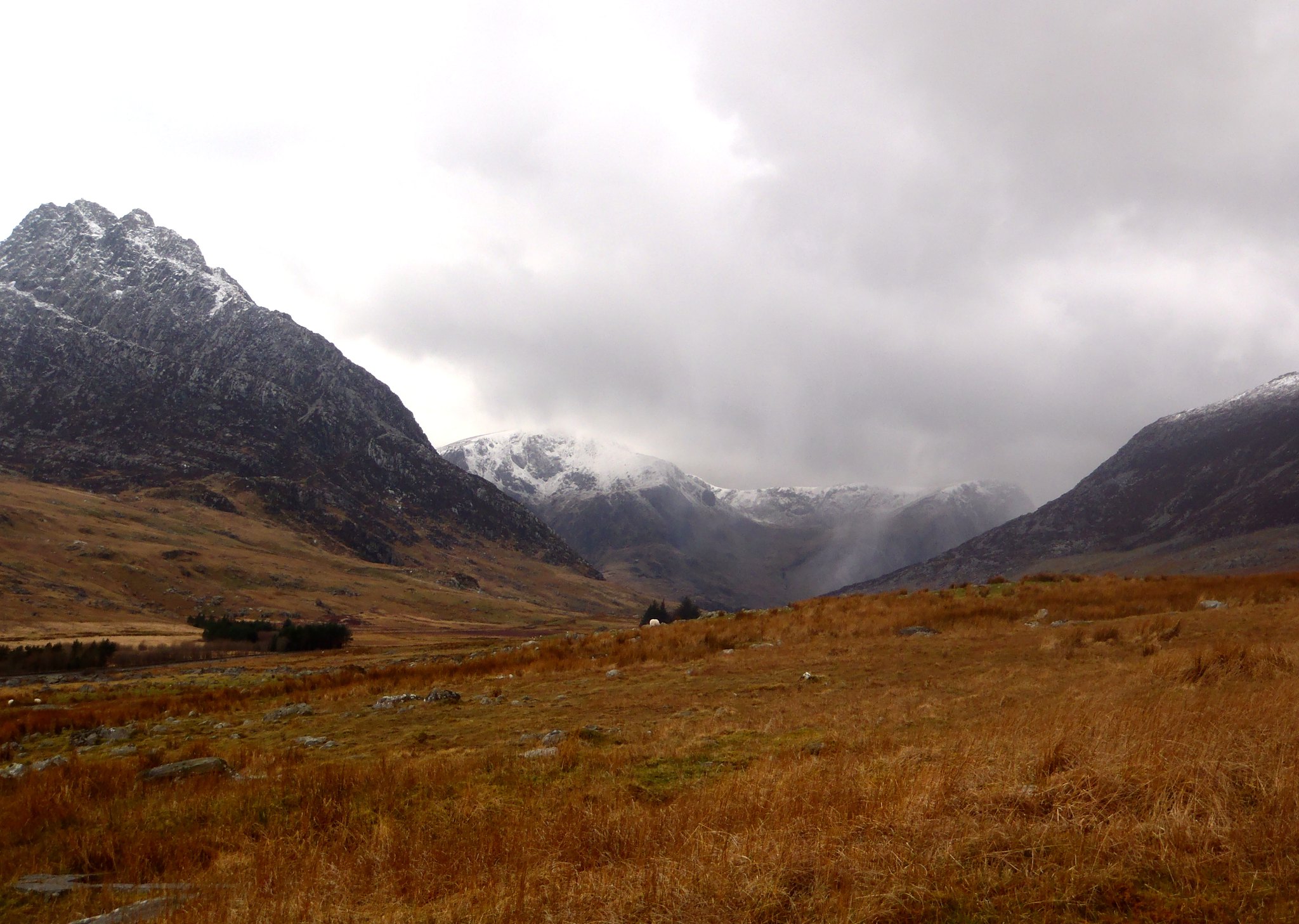
Glyder Fawr Mountaineering Day
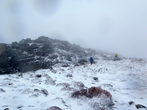
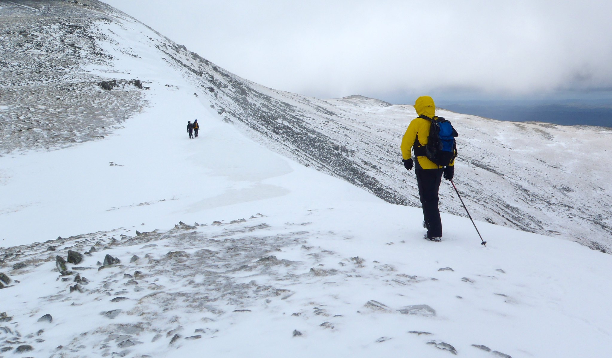
Today I was joined by Mike and Jon from Clwyd Mountaineering Club. The plan was to ascend Idwal Slabs via the Ordinary Route (Mod), scramble up to Continuation Wall and ascend via The Arete (VDiff, 24m). We were then to scramble across to the main Glyder Fawr cliff and take on the Central Arete (VDiff, 200m). The forecast was for rain from about midday, though, which didn't bode well for our later start of 0930...
We parked at the parking along Llyn Ogwen at SH656602. I originally intended to head direct to the Idwal Slabs from there, but Jon was wearing approach shoes and Mike via ferrata boots, both ideal for the climbing we were to do, but not for the peaty bog that lay ahead. So we detoured along the main A5 via Ogwen Cottage to keep our feet dry and cover the ground quickly.
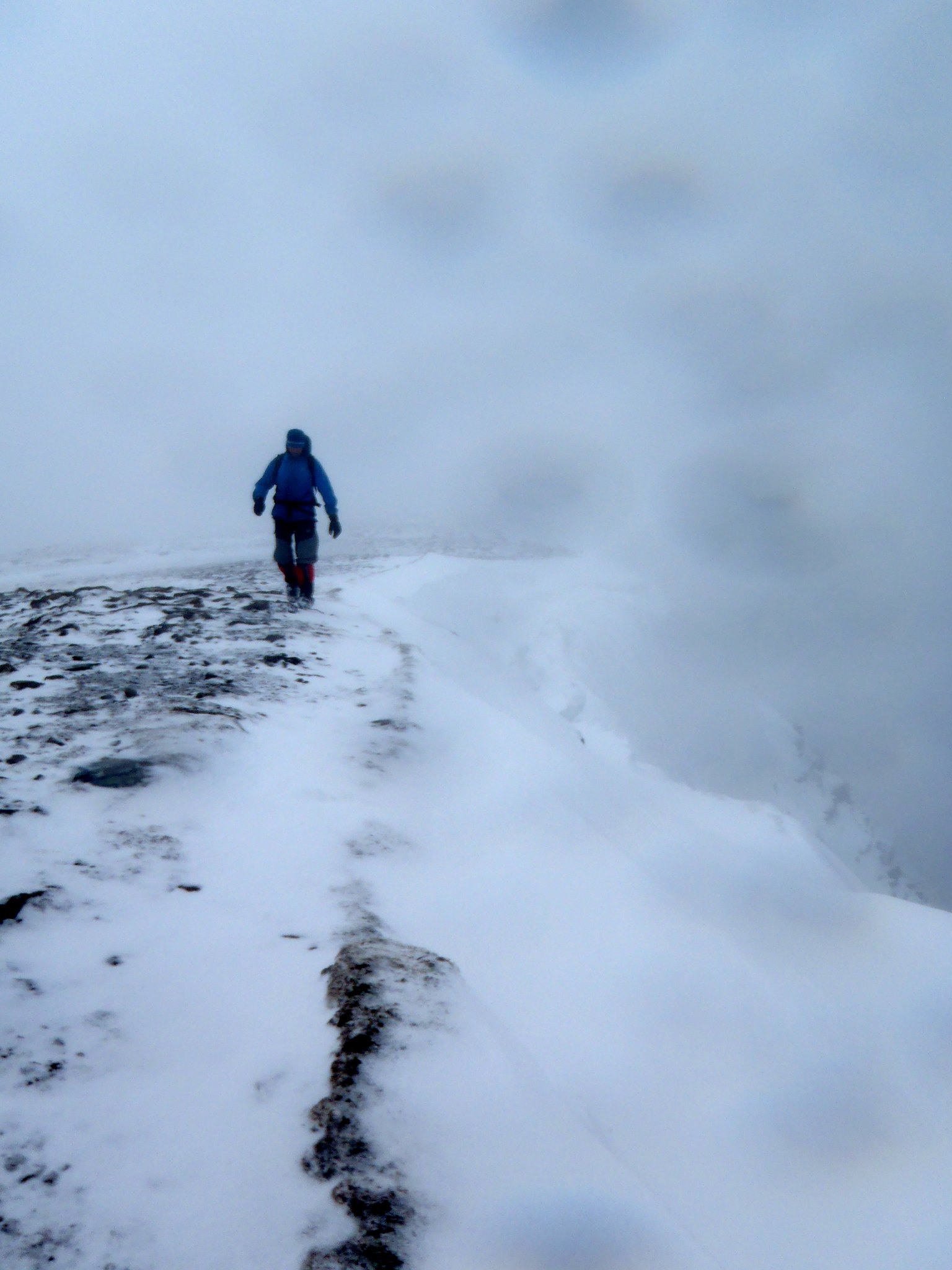
We arrived at the slabs at around 10am, which was reasonably quiet. We harnessed up quickly (to save time later) and, at Mike's suggestion, began to solo up Ordinary Route. The route was largely clear, and by soloing, we were able to keep ahead of the large group that was waiting to climb behind. We soon reached a woman belaying at around the 100m mark, and, after asking nicely, climbed past. We watched as her partner ascended the final steep section of the slab, waited for him to build his belay, then climbed past. Both were very polite and we didn't seem to disturb them with our soloing antics (a first for me!).
Once at the top of the route, we were then in a quandry: Jon had tried but failed to find the Arete before; and the directions I had brought were not very clear, not helped by the fact that I think I missed a page out of the photocopied entry from the guidebook! Luckily, I'd brought the original. By ascending further to the big arrow on the Slabs exit route, we eventually saw the small boulder perched on the cliff, then carefully traversed right to investigate further. We found the 3m wide quartz at the foot of the wall, but still took a while until we were certain that this was the route. Mike eyed up The Groove Above (S 4b), but I was in my big boots, so was keen to only stick on VDiffs. The Arete it was...
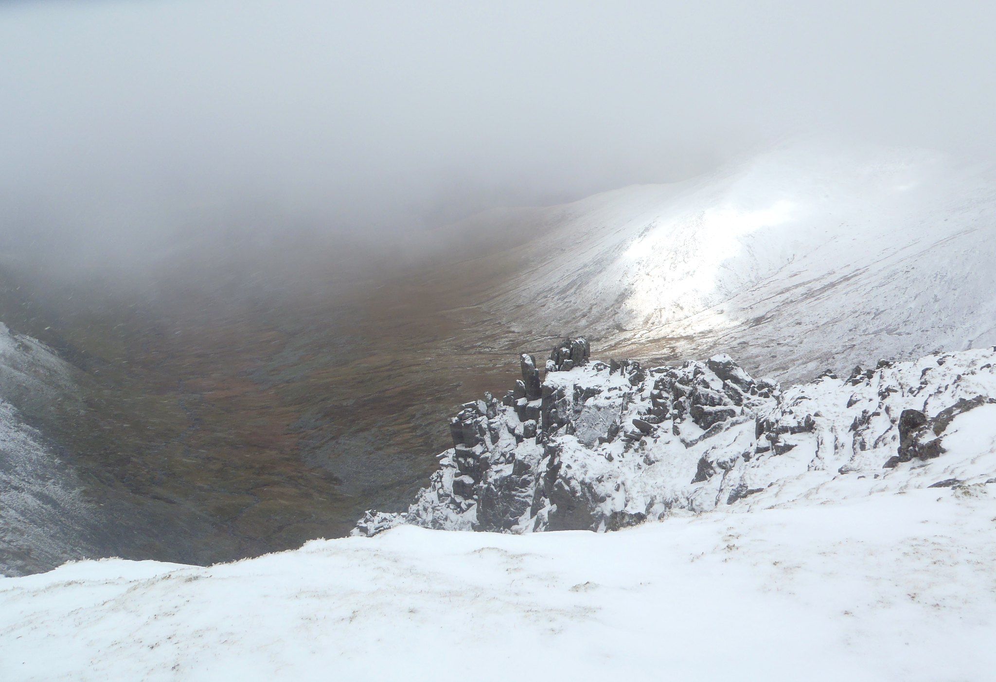
Although the route looked reasonable, finding the first protection was difficult. I jammed a nut in the right corner, mainly as reassurance, and placed a large sling. I then stepped up the centre of the wall to investigate a large gap: it would've been ideal for a sling and a 1930s style chockstone, but I didn't even have a hex to my name, so decided to leave it and stepped back down. I now stepped up and right into the corner, then walked up the terrace ledges, draping a sling over a small, 1in deep flake. The handholds here were better, so I made certain my feet and hands were secure before stepping left and placing a good nut in the only available space and continued up the arete. This was definitely a 'leader never falls' route: but at this point, I started to feel the wind buffet a little, which raised my awareness a notch. I continued on around the arete corner to the left, draped another sling over a small spike, then mantled up into the main shelf. I found a good place for another hex in a small shelf at the back, but was only able to rest a number 10 rock in it. Oh, it'd be fine for relatively static tension downward, but not a big fall. I thought that this might be a good belay point, and was quite keen to have company up here after such a bold route! After more fruitless searching for another decent placement, I decided it would be better to just get on with it, and to escape the final 'easy' part of the route, to the right and up onto the top of the arete: phew! Once on the top, a perfect couple of cracks welcomed me, and it was with these that I built my belay. Time to relax on the top and watch/listen to the boys struggle up below...
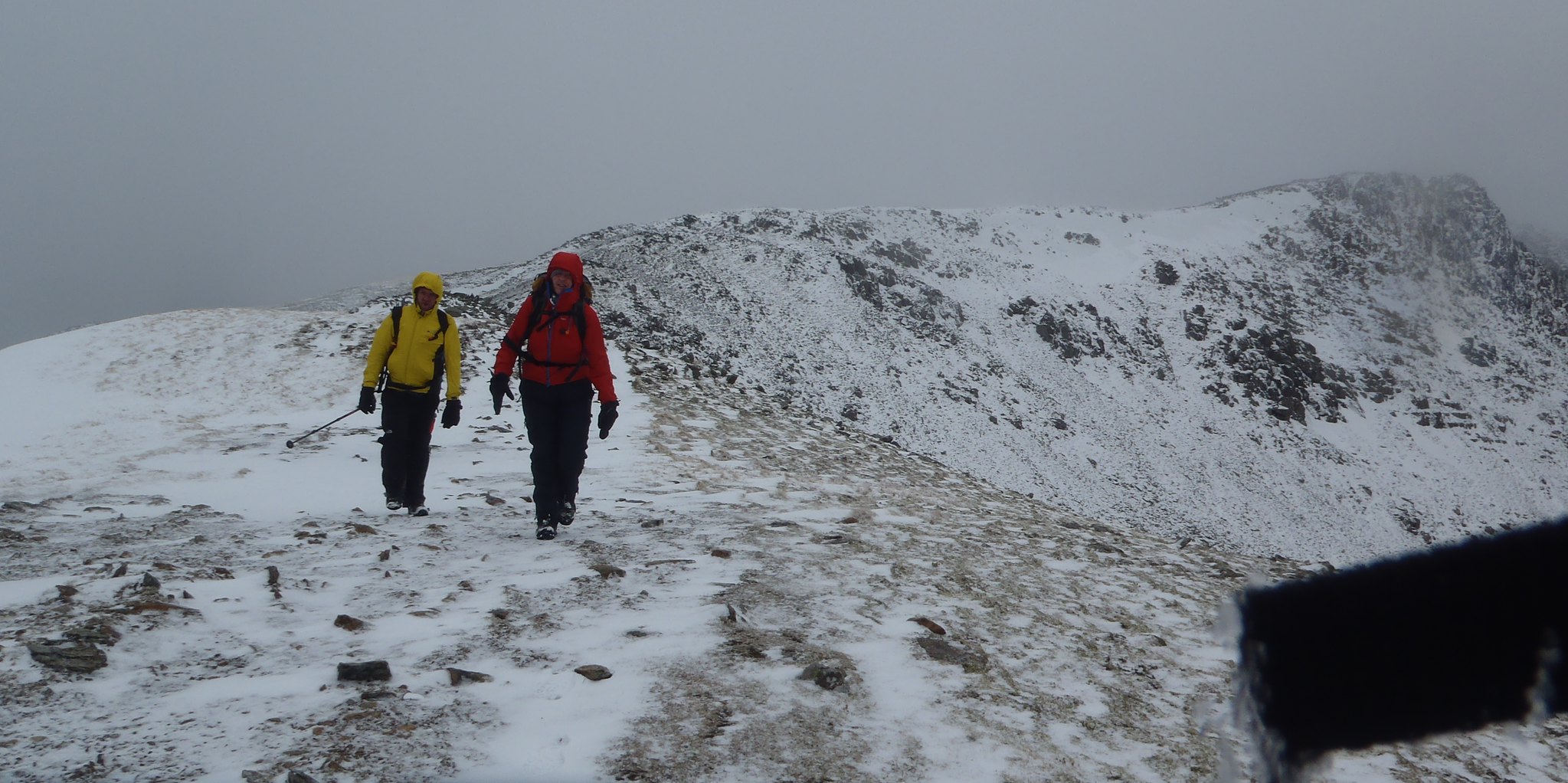
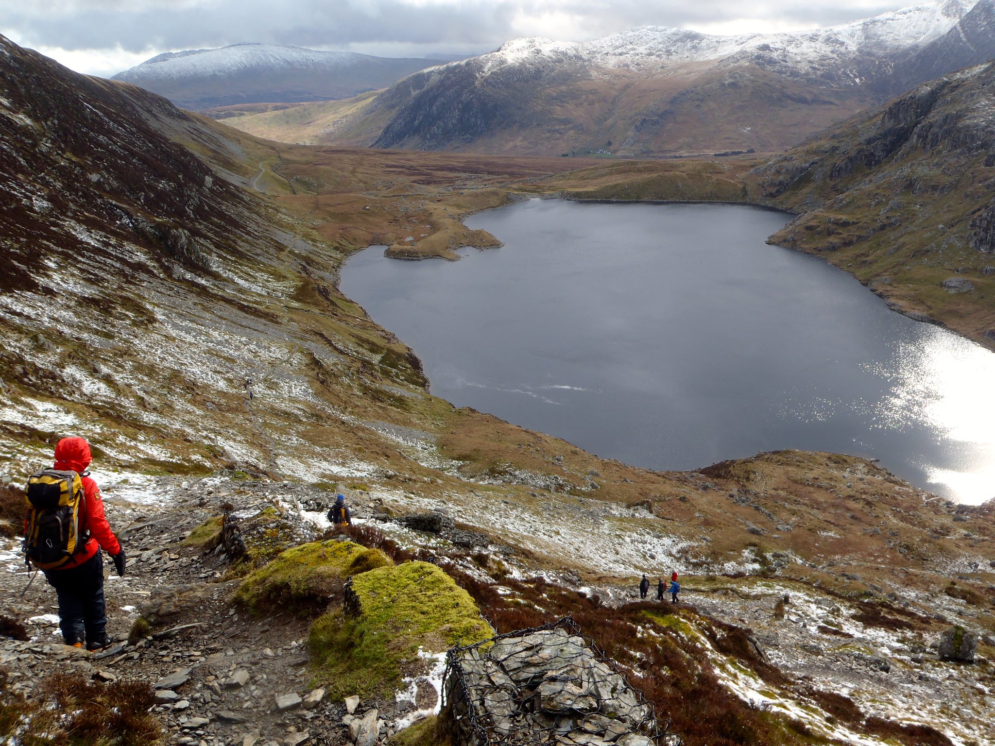
By the time Mike and Jon arrived at the belay, their were quite chilled, not helped by the coldness of the rock. It was 1pm: given that we'd escaped the showers so far, we chose to abandon an ascent via Central Arete, and instead to keep moving up Senior's Ridge. We headed up into the cloud, bagging the summit of Glyder Fawr just as a shower arrived. We continued rapidly down the scree slope to Llyn y Cwn: the rain stopped and we descended out of the cloud. As we came down through Devil's Kitchen and into the bottom of Cwm Idwal, we were able to both reflect on the routes we climbed and recce Central Arete for another, perhaps sunnier day. We will be back!
We parked at the parking along Llyn Ogwen at SH656602. I originally intended to head direct to the Idwal Slabs from there, but Jon was wearing approach shoes and Mike via ferrata boots, both ideal for the climbing we were to do, but not for the peaty bog that lay ahead. So we detoured along the main A5 via Ogwen Cottage to keep our feet dry and cover the ground quickly.
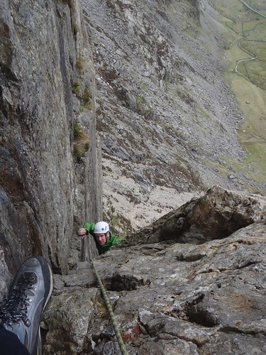
 |
| Soloing Ordinary Route (Mod) on the Idwal Slabs. |
We arrived at the slabs at around 10am, which was reasonably quiet. We harnessed up quickly (to save time later) and, at Mike's suggestion, began to solo up Ordinary Route. The route was largely clear, and by soloing, we were able to keep ahead of the large group that was waiting to climb behind. We soon reached a woman belaying at around the 100m mark, and, after asking nicely, climbed past. We watched as her partner ascended the final steep section of the slab, waited for him to build his belay, then climbed past. Both were very polite and we didn't seem to disturb them with our soloing antics (a first for me!).
 |
| Which way now? |
Once at the top of the route, we were then in a quandry: Jon had tried but failed to find the Arete before; and the directions I had brought were not very clear, not helped by the fact that I think I missed a page out of the photocopied entry from the guidebook! Luckily, I'd brought the original. By ascending further to the big arrow on the Slabs exit route, we eventually saw the small boulder perched on the cliff, then carefully traversed right to investigate further. We found the 3m wide quartz at the foot of the wall, but still took a while until we were certain that this was the route. Mike eyed up The Groove Above (S 4b), but I was in my big boots, so was keen to only stick on VDiffs. The Arete it was...
Although the route looked reasonable, finding the first protection was difficult. I jammed a nut in the right corner, mainly as reassurance, and placed a large sling. I then stepped up the centre of the wall to investigate a large gap: it would've been ideal for a sling and a 1930s style chockstone, but I didn't even have a hex to my name, so decided to leave it and stepped back down. I now stepped up and right into the corner, then walked up the terrace ledges, draping a sling over a small, 1in deep flake. The handholds here were better, so I made certain my feet and hands were secure before stepping left and placing a good nut in the only available space and continued up the arete. This was definitely a 'leader never falls' route: but at this point, I started to feel the wind buffet a little, which raised my awareness a notch. I continued on around the arete corner to the left, draped another sling over a small spike, then mantled up into the main shelf. I found a good place for another hex in a small shelf at the back, but was only able to rest a number 10 rock in it. Oh, it'd be fine for relatively static tension downward, but not a big fall. I thought that this might be a good belay point, and was quite keen to have company up here after such a bold route! After more fruitless searching for another decent placement, I decided it would be better to just get on with it, and to escape the final 'easy' part of the route, to the right and up onto the top of the arete: phew! Once on the top, a perfect couple of cracks welcomed me, and it was with these that I built my belay. Time to relax on the top and watch/listen to the boys struggle up below...
 |
| Mike and Jon, a bit chilly |
By the time Mike and Jon arrived at the belay, their were quite chilled, not helped by the coldness of the rock. It was 1pm: given that we'd escaped the showers so far, we chose to abandon an ascent via Central Arete, and instead to keep moving up Senior's Ridge. We headed up into the cloud, bagging the summit of Glyder Fawr just as a shower arrived. We continued rapidly down the scree slope to Llyn y Cwn: the rain stopped and we descended out of the cloud. As we came down through Devil's Kitchen and into the bottom of Cwm Idwal, we were able to both reflect on the routes we climbed and recce Central Arete for another, perhaps sunnier day. We will be back!
Friday, 11 April 2014
Snowdonia Conditions
It's been so warm of recent that virtually all of the snow has gone, apart from a few small, avoidable patches on the occasional north-facing slope. The thaw was exacerbated by the last week or so of relatively warm (and last weekend's very wet) weather.
The forecast for this weekend is high pressure pushing in from the southwest today. This will slowly be pushed back by the low pressure to the north of Scotland, which will drop temperatures, raise the winds to around 30mph on the tops and drag in a couple of weak cold fronts in the middle of Saturday, bringing a chance of drizzly showers. Sunday looks to be getting better, and Monday looks gorgeous!
This is my amateur interpretation of these sources:
- The met office surface pressure charts;
- Mountain Weather Information Service's Snowdonia forecast;
- Netweather.tv's ensemble view
As for me? I'm going climbing in the Ogwen Valley on some classic and airy VDiffs.
Have fun!
Sunday, 23 March 2014
Carneddau Conditions
Visibility has been so good that we can see both the Glyderau and the Carneddau in full from Bethesda. Here's a few gratuitous mountain shots. Enjoy!


Pen Yr Ole Wen, Carneddau Daffydd & Llewellyn from Glan Dena
Today, I took a group of 5 Clwyd Mountaineering Club colleagues and personal friends on a grand tour of the Carneddau. The forecast was for 30-35mph winds, increasing to 45-50mph, with snow and heavy snow.
I had been keeping an eye on conditions in the mountains all week. At the beginning of the week, there had been very little snow, but by Friday evening there was a light dusting on the tops. Given how the low level precipitation had consisted of brief showers, sometimes of hail, I presumed that there would only be powdery snow around, with possibly some hailstones. There was also likely to be rime ice on the tops, given the recent high humidity levels.
The route took us from Glan Dena (SH668605) along the side of Llyn Ogwen; up Pen Yr Ole Wen from Ogwen Cottage; over Dafydd and Llewellyn; over Craig yr Ysfa; then back to the start along the access road, over to the Roman road and down the valley.
The weather was clear until we started the Pen Yr Ole Wen ascent, and occasional light snow flurries silently swirled around us. As we went higher, the clouds descended and the winds increased. The snow was, as expected, powdery and sticky, a bit like the first falls of snow that make small children excited and then melt the next day. It made solid boot prints and easy walking. Group management was key at this point because the group's steep ground climbing fitness varied from mountain runner and cyclist via alpine walker to flat terrain legs. Thankfully, everyone helped out and we kept together reasonably well, or at the least in two small groups without too much separation.
As 'Leader', it was left to me navigate over the tops, where visibility was poor (around 100m). At one point I truly felt like the leader, when the group gathered around me as I explained how I was going to get us from the summit of Pen Yr Ole Wen to that of Dafydd. I explained how our pace of approx 4km per hour would take us 12 minutes to cover 800m, then add 1 minute for every 10m of the 110m ascent. This gave us an ETA of 23 minutes. At the same time, I paced it. The timing was 1 minute short; my pacing (due to icy patches and some deep snow drifts) was on the short side, needing another 200m! Good experience for me, and it felt good sharing the knowledge.
After Dafydd, the clouds cleared occasionally to give us excellent views down Cwn Llafar to the north, and even as far as the Denighshire Moors and Clwydian Range in the east.
As we crossed the Bwlch Cwyfrw-Drum, the winds really started to gust. Fortunately, it wasn't so strong as to make walking impossible, but you just had to be ready to transition from the no-wind to strong-wind (leaning left) moments! We picked up the north-south wall near the top of Llewellyn with the intention of sheltering a bit: it might have helped, but the wind was so fierce that we decided to avoid the summit proper, then descend east toward Craig yr Ysgfa. At one point (SH686643) the snow had been scoured and completely covered the path in ice, for about 10m. There had obviously been only one walker over this stretch when it was snow because vague boot prints were still carved in the ice. An ice axe might have been of use here, to cut the steps more positively; but in the end we managed to cross it without incident. The consequences of a slip were minor, the slope reasonably short and flattening out into powder and scree just below.
Thereafter, the walk itself was fairly inconsequential, apart from the really vicious but brief spindrift squalls that seemed to pick up on the west side of Ysfa. Given the late hour, we decided to avoid Pen Yr Helgi Du (boo) and continue down the access road to the A5, cross to the Roman Road at Gwern Gof Isaf Farm, then head directly back to Glan Dena. As approached, we could see squalls of precipitation heading up the valley from Y Garn. Then the lightning and thunder struck. No problem, we were relatively safe in the valley. But the consequent hail was unrelenting for the final 1km: 5mm balls of ice pounding thin waterproof layers like being flicked by an annoying bully hundreds of times per minute.
But we we're back!
(Photos also on Flickr)
I had been keeping an eye on conditions in the mountains all week. At the beginning of the week, there had been very little snow, but by Friday evening there was a light dusting on the tops. Given how the low level precipitation had consisted of brief showers, sometimes of hail, I presumed that there would only be powdery snow around, with possibly some hailstones. There was also likely to be rime ice on the tops, given the recent high humidity levels.
The route took us from Glan Dena (SH668605) along the side of Llyn Ogwen; up Pen Yr Ole Wen from Ogwen Cottage; over Dafydd and Llewellyn; over Craig yr Ysfa; then back to the start along the access road, over to the Roman road and down the valley.
The weather was clear until we started the Pen Yr Ole Wen ascent, and occasional light snow flurries silently swirled around us. As we went higher, the clouds descended and the winds increased. The snow was, as expected, powdery and sticky, a bit like the first falls of snow that make small children excited and then melt the next day. It made solid boot prints and easy walking. Group management was key at this point because the group's steep ground climbing fitness varied from mountain runner and cyclist via alpine walker to flat terrain legs. Thankfully, everyone helped out and we kept together reasonably well, or at the least in two small groups without too much separation.
As 'Leader', it was left to me navigate over the tops, where visibility was poor (around 100m). At one point I truly felt like the leader, when the group gathered around me as I explained how I was going to get us from the summit of Pen Yr Ole Wen to that of Dafydd. I explained how our pace of approx 4km per hour would take us 12 minutes to cover 800m, then add 1 minute for every 10m of the 110m ascent. This gave us an ETA of 23 minutes. At the same time, I paced it. The timing was 1 minute short; my pacing (due to icy patches and some deep snow drifts) was on the short side, needing another 200m! Good experience for me, and it felt good sharing the knowledge.
After Dafydd, the clouds cleared occasionally to give us excellent views down Cwn Llafar to the north, and even as far as the Denighshire Moors and Clwydian Range in the east.
As we crossed the Bwlch Cwyfrw-Drum, the winds really started to gust. Fortunately, it wasn't so strong as to make walking impossible, but you just had to be ready to transition from the no-wind to strong-wind (leaning left) moments! We picked up the north-south wall near the top of Llewellyn with the intention of sheltering a bit: it might have helped, but the wind was so fierce that we decided to avoid the summit proper, then descend east toward Craig yr Ysgfa. At one point (SH686643) the snow had been scoured and completely covered the path in ice, for about 10m. There had obviously been only one walker over this stretch when it was snow because vague boot prints were still carved in the ice. An ice axe might have been of use here, to cut the steps more positively; but in the end we managed to cross it without incident. The consequences of a slip were minor, the slope reasonably short and flattening out into powder and scree just below.
Thereafter, the walk itself was fairly inconsequential, apart from the really vicious but brief spindrift squalls that seemed to pick up on the west side of Ysfa. Given the late hour, we decided to avoid Pen Yr Helgi Du (boo) and continue down the access road to the A5, cross to the Roman Road at Gwern Gof Isaf Farm, then head directly back to Glan Dena. As approached, we could see squalls of precipitation heading up the valley from Y Garn. Then the lightning and thunder struck. No problem, we were relatively safe in the valley. But the consequent hail was unrelenting for the final 1km: 5mm balls of ice pounding thin waterproof layers like being flicked by an annoying bully hundreds of times per minute.
But we we're back!
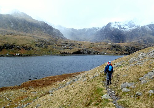
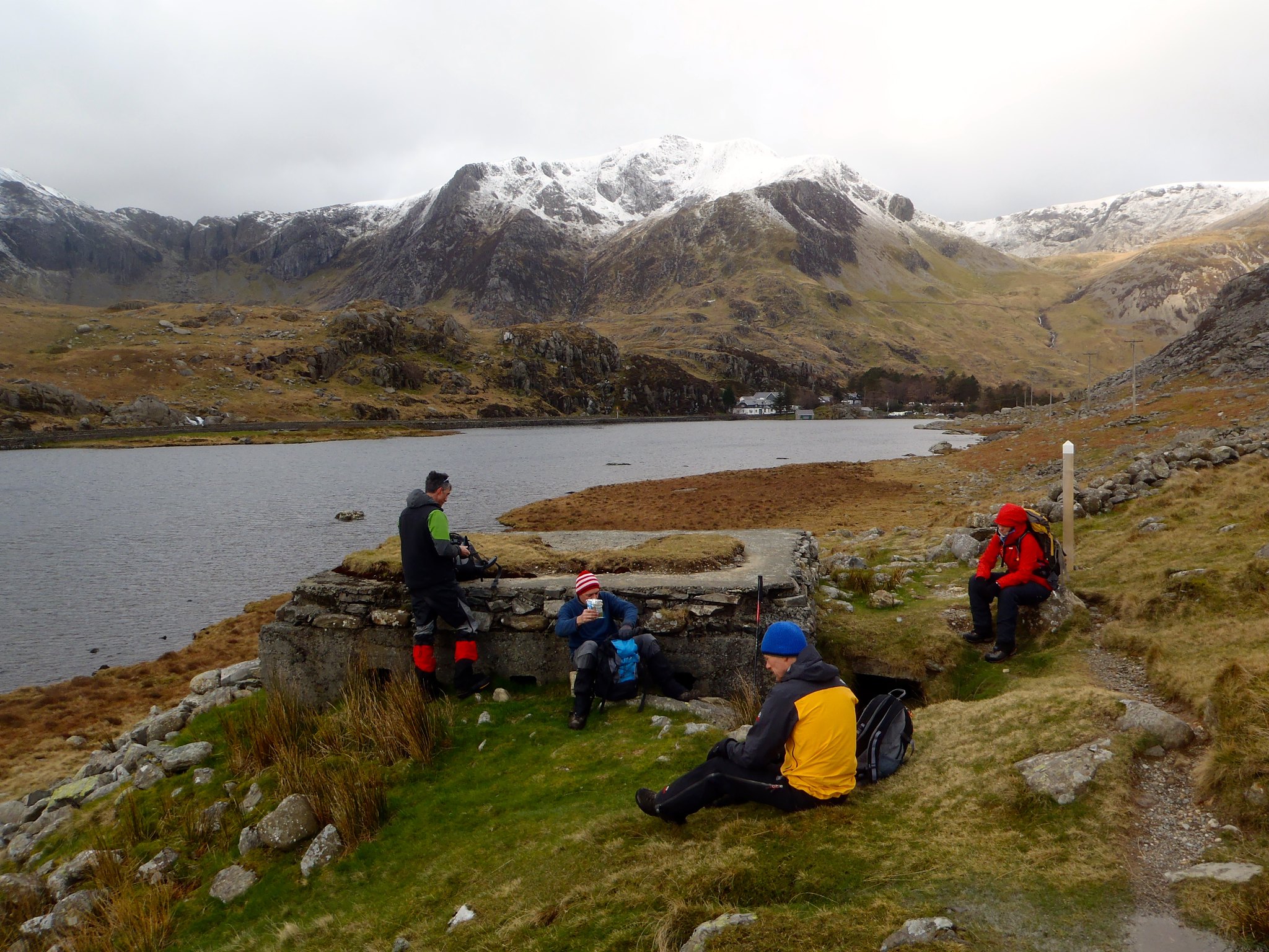 |
| A brief pause at the pillbox on the north shore of Llyn Ogwen |
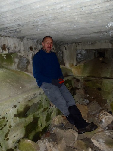 |
| Al inside the pill box |
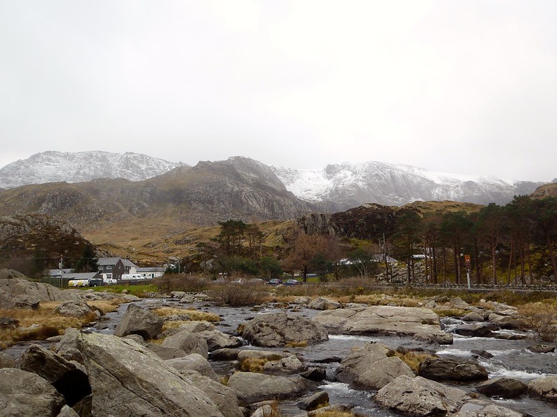 |
| Glyderau and Ogwen Cottage |
 |
| Secret bridge under the A5! |
 |
| The snow showers arrive. |
 |
| Snowy near the top of Pen Yr Ole Wen |
 |
| Icy cornices along Ysgolion Duon |
 |
| Cwm Llafar and Yr Elen (in the sunlight) from the top of Ysgolion Duon |
 |
| Crossing the Bwlch, wind blowing right to left (notice the leaning!) |
 |
| Ascending Llewellyn from the Bwlch |
 |
| The well-worn path down from Craig yr Ysfa |
 |
| The hailstorm arriving up Cwm Ogwen from Y Garn past Tryfan |
(Photos also on Flickr)
Friday, 21 March 2014
Carneddau Conditions 21 March 2014
Just a quick update: for anyone walking the Carneddau this weekend, there's a little bit of white stuff on the tops. I don't expect it to be very icy, more likely to be hail stones and drifting powder. The winds are easing, though, so walking will be slightly less difficult.
More of the same expected tomorrow. Have fun, and be safe out there!

Sunday, 9 March 2014
Pen Y Pass to Llanberis via Glyder Fawr
If there was ever a sign that winter was over, then frogspawn is it. At Llyn y Cwn, we passed once or twice foot-wide heaps of tadpoles encased in jelly. But what about the rest of the mountains?
Today's route (Saturday, 8th March, 2014) took us from the Pen-y-Pass Youth Hostel, over Glyder Fawr, then down to follow the ridge north over Y Garn, Foel Goch and Elider Fawr, finishing down through the Dinorwig Slate Quarries. I was accompanied by long-time friend and local Llanberis resident, Dave. We hopped on the Sherpa bus outside Joe Brown's in Llanberis at 0920, which took us up to Pen-y-Pass for 0930.
The surface pressure charts suggested that the winds would be around 40-60mph on the summits, coming from the south. We'd walked in conditions like this before, but it was expected to become less fierce as the day continued. And the forecast wasn't far off.
Avoiding the building works around the hostel, we approached LlynCwnfynnon without descending into the bogs, and were very sheltered as we walked up past Llyn Cwnfynnon and Bwlch Dwyglydion. It was foggy all the way, with the clouds only briefly lifting once for a few seconds to show me that my navigation was working!
As we approached the top of the Bwlch, small sheltered areas remained covered in snow, but most of the ground was clear. We reached the top of the Bwlch and the winds continued to increase in strength. Turning west, walking toward the summit of Glyder Fawr became increasingly difficult. I opted to stay south of the main path, off the main ridge, but even so, the winds continued to increase.
Using pacing, I managed to hit the multiple rock towers of Glyder Fawr almost directly. We inched our way toward one of the crags from our downhill/upwind position, then hid behind it in the lea, refuelling while the wind whistled the clouds past at astonishing speed. If felt as though we were in an industrial tumbledryer!
Now that we were out of the wind, we were able to progress. I located the descent path easily (for once). Following the cairns, we headed down the scree slope path, it became covered in snow. We assessed it and found it to be made of icy crystals, but largely soft enough to dig heels into. Dave rushed down over it (being an experienced fell runner), while I carefully made my way across. At about this time the clouds cleared and we could see that most of the mountains were completely clear of snow.
Heading down to Llyn y Cwn was straightforward, if gusty, as was the start to Y Garn. The wind felt to be coming largely from the southwest, obviously passing around the bulk of Glyder Fawr. We decided that we would see how strong the wind was as we ascended and if it was too strong, we would miss the summit and countour around to the west to avoid being blown off the mountain. It turned out to not be too bad: walking the zigzag path downwind was a doddle, while upwind was like a 60º slope! We made it to the top, but decided to avoid the summit cairn and head down the other side rapidly.
As we descended, the ridge of Elider Fawr was clear. We had to decide whether it was sensible to continue on our planned route. Given the continuing strength of the wind (and the exhausting effect it had so far had on us), we chose not to continue along the east-west path over Elidir Fawr, and instead decided to bail out down Cwm Dododyn to the south. I explained the principle of contouring down rather than descending then re-ascending, so we skirted farther north to pick up the path as far up the Cwm as possible. We followed the path until we passed an abandoned smallholding, then left the path, maintaining our height on the mountain. Following this direction brought us to the top of the Dinorwig Slate Quarries.
The quarries are always interesting, but I'd never yet visited the higher levels. It was now Dave's turn to lead, and he took me through Shed Mawr, down to the Canteen (graffiti'ed by centuries of quarrymen and visitors) and toward the climbing areas that I knew (Australia, Dali's Hole). We continued down the path past the Anglesey Barracks and on to Pete's Eats for a welcome cream-and-marshallow topped Hot Chocolate. Well earned!
Today's route (Saturday, 8th March, 2014) took us from the Pen-y-Pass Youth Hostel, over Glyder Fawr, then down to follow the ridge north over Y Garn, Foel Goch and Elider Fawr, finishing down through the Dinorwig Slate Quarries. I was accompanied by long-time friend and local Llanberis resident, Dave. We hopped on the Sherpa bus outside Joe Brown's in Llanberis at 0920, which took us up to Pen-y-Pass for 0930.
The surface pressure charts suggested that the winds would be around 40-60mph on the summits, coming from the south. We'd walked in conditions like this before, but it was expected to become less fierce as the day continued. And the forecast wasn't far off.
Avoiding the building works around the hostel, we approached LlynCwnfynnon without descending into the bogs, and were very sheltered as we walked up past Llyn Cwnfynnon and Bwlch Dwyglydion. It was foggy all the way, with the clouds only briefly lifting once for a few seconds to show me that my navigation was working!
| Cloud clearing for seconds in Bwlch Dwyglydion |
As we approached the top of the Bwlch, small sheltered areas remained covered in snow, but most of the ground was clear. We reached the top of the Bwlch and the winds continued to increase in strength. Turning west, walking toward the summit of Glyder Fawr became increasingly difficult. I opted to stay south of the main path, off the main ridge, but even so, the winds continued to increase.
Using pacing, I managed to hit the multiple rock towers of Glyder Fawr almost directly. We inched our way toward one of the crags from our downhill/upwind position, then hid behind it in the lea, refuelling while the wind whistled the clouds past at astonishing speed. If felt as though we were in an industrial tumbledryer!
Now that we were out of the wind, we were able to progress. I located the descent path easily (for once). Following the cairns, we headed down the scree slope path, it became covered in snow. We assessed it and found it to be made of icy crystals, but largely soft enough to dig heels into. Dave rushed down over it (being an experienced fell runner), while I carefully made my way across. At about this time the clouds cleared and we could see that most of the mountains were completely clear of snow.
 |
| Descending Glyder Fawr to the north and Llyn y Cwn |
 |
| Tryfan and Pen Yr Ole Wen from Glyder Fawr's north path |
Heading down to Llyn y Cwn was straightforward, if gusty, as was the start to Y Garn. The wind felt to be coming largely from the southwest, obviously passing around the bulk of Glyder Fawr. We decided that we would see how strong the wind was as we ascended and if it was too strong, we would miss the summit and countour around to the west to avoid being blown off the mountain. It turned out to not be too bad: walking the zigzag path downwind was a doddle, while upwind was like a 60º slope! We made it to the top, but decided to avoid the summit cairn and head down the other side rapidly.
As we descended, the ridge of Elider Fawr was clear. We had to decide whether it was sensible to continue on our planned route. Given the continuing strength of the wind (and the exhausting effect it had so far had on us), we chose not to continue along the east-west path over Elidir Fawr, and instead decided to bail out down Cwm Dododyn to the south. I explained the principle of contouring down rather than descending then re-ascending, so we skirted farther north to pick up the path as far up the Cwm as possible. We followed the path until we passed an abandoned smallholding, then left the path, maintaining our height on the mountain. Following this direction brought us to the top of the Dinorwig Slate Quarries.
The quarries are always interesting, but I'd never yet visited the higher levels. It was now Dave's turn to lead, and he took me through Shed Mawr, down to the Canteen (graffiti'ed by centuries of quarrymen and visitors) and toward the climbing areas that I knew (Australia, Dali's Hole). We continued down the path past the Anglesey Barracks and on to Pete's Eats for a welcome cream-and-marshallow topped Hot Chocolate. Well earned!
 |
| Shed Mawr slate cutting equipment |
 |
| Inside the canteen: a self-maintaining and human mausoleum to Llanberis's slate industry |
 |
| Looking over The Lost World to the Twll Mawr gap and Llyn Peris |
 |
| Anglesey Barracks, where the quarrymen from Anglesey lived during the week |
Monday, 3 March 2014
Moelwyn Mawr and Allt Mawr, Saturday
On Saturday, I guided walking friend Craig around Moelwyn Mawr and Allt Mawr.
The Met office forecast predicted heavy snow and black clouds after 9am. Amidst these warnings, and aware that Craig is in rehabilitation after a knee operation, I planned a route that would a) avoid steep, avalanche prone slopes, and b) not be too hard on the knees. This meant choosing a route based on widely-spaced contour lines.
In the end, we had a couple of flurries of snow interspersed with broken cloud and spells of glorious sunshine. The weather threatens to be colder overnight, but I still don't think that there'll be significant snowfall in the area. And we picked off Moel Druman, Allt Mawr and Moelwyn Mawr Hewitts without any ado.
View Larger Map
Tuesday, 26 November 2013
Walking the Moelwyns
Walking Moelwyn Mawr and Bach
This weekend was a bit of an big trip for me: A wild camp in the Moelwyns/Moelwynion, with 17 miles of walking and over a mile of ascent. No matter how I try, I still don't feel able to lighten my pack enough, and the strain on my knees was really telling by the end of the trip! The adventurous route started from Blaenaeu Dolwyddelan, up Yr Arddu, detoured to Cnicht, then doubled-back to Moelwyn Mawr and Bach. after a brief camp around there somewhere, I then planned to head back as directly as possible to the start point.
The weather in the week leading up had been a mix of cold, heavy snow and sunshine. I arrived Saturday, (23rd November) morning at Blaenau Dolwyddelan to temperatures of -4°C in the valleys and beautiful frost. I had packed crampons and ice axe in the van just in case, but on arrival the tops were clear and these obviously weren't needed, so were left behind. The low winter sun shone all day, slowly turning the firm but nicely frozen tundra on the Moelwyns into their typical boggy condition.
 |
| Allt Fawr and Moel Druman on a frosty start from Blaenau Dolwyddelan |
 |
| Frosty! |
 |
| Ice, formed some days earlier, on Yr Arddu |
 |
| Looking over to Allt-fawr and Moel Druman from Yr Arddu, 53.032608, -3.984698 |
 |
| Frosty Llynau'r Cwn |
I trekked over Yr Arddu, Cnicht, and just about had time to make it up Moelwyn Mawr and Bach before sunset.
 |
| A busy Cnicht |
 |
| Moelwyn Bach and Trawsfynydd on the way up the east side of Moelwyn Mawr |
 |
| Summit of Moelwyn Mawr - no snow. |
 |
| Sunset reflecting in the sea beyond Portmadog over Moelwyn Bach. |
After arriving back down at the abandoned quarries at Cwmorthin in the almost-complete darkness, I night-nav'ed to find a sufficient camp-site near Llyn Cwm-corsiog. The stars were only partly visible through the broken cloud, but still very impressive, despite a little bit of light pollution coming up Cwm Cwmorthin from Blaenaeu Ffestiniog. It was late and I wasn't particularly hungry, so I drank some more water to re-hydrate (I'm terrible at drinking enough during the day), then settled down for the night without supper, snug in my Rab Ascent 700 down sleeping bag.
I slept on-and-off between 1930 and 2230, then only stirred thereafter for the occasional curl up until waking at 0615. The temperatures didn't drop below 0 overnight: the ground just remained damp. Dawn arrived with very little fanfare, just a brightening of the grey overcast sky. But at least it wasn't raining, or windy!
 |
| A dull overcast dawn overlooking Llyn Cwm-corsiog and Moel Druman. Not as dry as it looked... |
Soon, though, my cold, damp, FREEZING feet told me it was time to get a move on! I headed indirectly toward Moel Druman by skirting around the contours to Llyn Terfyn then along the path. After summitting Druman I continued northeast, past Allt-fawr (one peak too many!), over Moel Dyrnogydd, then along the miner's trail and across the horrible, ankle-twisting-tussocked scrub to Hendre Farm and my starting point.
Snowdon & Glyderau Conditions
Conditions in the Snowdon and Glyder massifs looked impressive from the Moelwyns this weekend:Snow was above 600m, so both Crib Goch, and Crib y Ddysgl were covered.

There was also significant snow cover on the Glyders, although Y Foel Goch (to the southeast) and Y Garn (to the north) did not appear to have any settled frozen stuff.

Saturday's Route View Larger Map
Sunday's Route View Larger Map
Wednesday, 2 October 2013
Dinas Cromlech For Beginners
On a sunny Saturday in June 2013, Craig and I went to Dinas Cromlech. It was to be our first multipitch climbing adventure, on our own, without grown-up supervision, so we were considering one or two classic VDiffs to gain experience "out there". We arrived at 8am, a time that we thought would be early enough, at Cromlech Boulders just in time to bag the last parking space. In my pack was my brand-new, shiny, unscratched rack, ready for action: no more borrowed gear for me! To add to the atmosphere and experience, I had decided, in my wisdom, that I should ape, as closely as I could, the gear used by the first ascensionists of these routes. So with my La Sportiva Trango Alp boots on my feet (the nearest I could get to hobnail boots) rather than tight-fitting rock shoes, we started up the access path to the crag.
We chose to begin on the Flying Buttress. Flying Buttress is a classic route in the true meaning of the word: enjoyable moves, flowing rock, not too difficult, but a tangible sense of adventure (mainly through overhanging exposure). In no hurry, we allowed another pair to go ahead of us to allow us to relax and absorb the atmosphere of the Cromlech City.
Craig led the first pitch, which in reality was a steep and slightly polished scramble. I led the second, which was more of the same, but slightly complicated by a short descending section into a gully at the end. Craig's turn again: pitch 3 begins with an exciting and exposed traverse around the cliff face, before heading upward to the belay point. Then, surprisingly (to me, anyway), he didn't stop. He managed to combine the sinuous (but straightforward) pitch 4 while using a single rope and introducing virtually no drag. I was impressed! This did, however, leave the final angled chimney pitch to me. I used a combination of classic sling usage technique and modern camming (use ‘em where you can!) to gain advantage over the early 20th century gentlemen climbers. It didn't make getting into the chimney any easier though, and I found that a traditional "beast" technique eventually won the day.
Having polished one multi-pitch route off to our satisfaction, we were eager for more. The next VDiff on the Cromlech, heading back toward the path, is Spiral Stairs. This has a scramble for the first "pitch", one that has since become the main access for the famous E1+ routes like Cenotaph Corner and Cemetary Gates. Eager to practice our belay building, we roped up anyway and managed to partially obstruct anyone trying to access the aforementioned famous routes.
After the scramble, the second pitch was again Craig’s honour and again an exposed overhanging traverse. He appeared to be getting quite confident at this point! I cleared my belay and climbed past him and on toward "The Forest". Here we bumped into the team who went up Flying Buttress before us, and assumed that they were again on the same route as us: Spiral Stairs. It didn’t twig that we hadn’t seen them on the first 2 pitches. I waited for them to clear the belay below a very impressive, almost vertical "off-width" crack. At least, I think it was off width: it was definitely wider than a fist, perhaps even wider than a solid, modern, mountaineering boot.
"Can I lead this one, Craig? You’ve had all the exciting stuff so far!", I begged. And so, with Craig’s resigned blessing, it fell to me to lead what I thought was the next pitch of Spiral Stairs. After the first couple of moves up a short pinnacle, I was having doubts. By the time I’d climbed about 10m with very tenuous gear, limited holds and an iffy sling, I was just thinking about how to get out of there. Can we ab out? No, I’d have to leave something behind. What’s my fall factor looking like? It's okay, apart from that narrow shelf about 2m below. Where are the hand holds? Can you smear in boots? Why are there so many perfect rock shoe holds?! There’s no way I’m calling mountain rescue, I know people on the Llanberis MRT! And they're busy enough as it is without worrying about muppets who exceed their abilities. Time to "Man Up" then!
Eventually, with the mantra “trust the shoes” ringing in my ears, I did indeed "Man Up" and plumped for a boot jammed in the crack, which was only just narrow enough, and stepped up for a positive hold. Phew, what relief! Big boots do have their place, just as they did on the First Ascent in 1931. After then, the climb was relatively simple, completed by my beasting several moves further to the top. Here I found a traditional 1930s belay anchor rock the size of a small car, solid and immovable. I walked the rope around it, clove-hitched in and prepared to belay Craig. He followed up shortly with the words, “there’s no way that’s a VDiff!”. Quite.
Once safe, we reflected on the North Wales Rock guide. It appeared that our route finding had been a little off, and in my excitement to see the other climbers I’d inadvertently followed them up Pitch 2 of Sabre Cut (VS 4c), which I have on good authority is "a hard pitch at VS too". Self-sand-bagged!!
After all the excitement, we picked our way delicately back down the loose and potentially lethal descent path. Following a brief chat with a "hypothermic" Stu McAleese concerning the dampness on Cenotaph Corner, we returned to the car then toddled off to the Heights in Llanberis for a self-congratulatory pint for out-smarting Nature and not becoming a Darwin Awards statistic.
Right, when’s the next adventure?
Flying Buttress VDiff
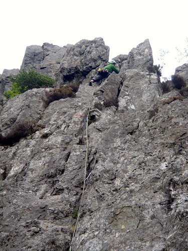 |
| Pitch 1, Flying Buttress |
Craig led the first pitch, which in reality was a steep and slightly polished scramble. I led the second, which was more of the same, but slightly complicated by a short descending section into a gully at the end. Craig's turn again: pitch 3 begins with an exciting and exposed traverse around the cliff face, before heading upward to the belay point. Then, surprisingly (to me, anyway), he didn't stop. He managed to combine the sinuous (but straightforward) pitch 4 while using a single rope and introducing virtually no drag. I was impressed! This did, however, leave the final angled chimney pitch to me. I used a combination of classic sling usage technique and modern camming (use ‘em where you can!) to gain advantage over the early 20th century gentlemen climbers. It didn't make getting into the chimney any easier though, and I found that a traditional "beast" technique eventually won the day.
Spiral Stairs VDiff (Partly)
 |
| Pitch 2, Spiral Stairs: exposure included |
After the scramble, the second pitch was again Craig’s honour and again an exposed overhanging traverse. He appeared to be getting quite confident at this point! I cleared my belay and climbed past him and on toward "The Forest". Here we bumped into the team who went up Flying Buttress before us, and assumed that they were again on the same route as us: Spiral Stairs. It didn’t twig that we hadn’t seen them on the first 2 pitches. I waited for them to clear the belay below a very impressive, almost vertical "off-width" crack. At least, I think it was off width: it was definitely wider than a fist, perhaps even wider than a solid, modern, mountaineering boot.
Wrong Way
 |
| Not Spiral Stairs! |
Eventually, with the mantra “trust the shoes” ringing in my ears, I did indeed "Man Up" and plumped for a boot jammed in the crack, which was only just narrow enough, and stepped up for a positive hold. Phew, what relief! Big boots do have their place, just as they did on the First Ascent in 1931. After then, the climb was relatively simple, completed by my beasting several moves further to the top. Here I found a traditional 1930s belay anchor rock the size of a small car, solid and immovable. I walked the rope around it, clove-hitched in and prepared to belay Craig. He followed up shortly with the words, “there’s no way that’s a VDiff!”. Quite.
Reflection
 |
| Happy clamberers |
After all the excitement, we picked our way delicately back down the loose and potentially lethal descent path. Following a brief chat with a "hypothermic" Stu McAleese concerning the dampness on Cenotaph Corner, we returned to the car then toddled off to the Heights in Llanberis for a self-congratulatory pint for out-smarting Nature and not becoming a Darwin Awards statistic.
Right, when’s the next adventure?
Subscribe to:
Posts (Atom)