Monday, 19 August 2013

Moel Siabod, by Lizzie, Mountaineer (Aged 7¾)

Candy Floss

Daddy had been saying he would take me up another mountain for ages. Today he suggested Moel Siabod.

I've been on two mountain walks before: Y Fal (Sugar Loaf) in the Brecon Beacons and Devil's Kitchen in the snow.

I hoped it would be cloudy. I've always wanted to taste the clouds. I think they will taste of candy floss. Daddy says they're just wet.

Tangfastics

Daddy parked at Bryn Glo, a free car park at the south end of the A5 just as it leaves Capel Curig. He did his jammy trick of finding the last free space again.

The weather was Sunny, clear and warm. Not too hot or humid, nor too cold: just right.

First we walked carefully along the busy road, then over a very old bridge called Pont Cyfyng. Daddy says "pont" is Welsh for "bridge". He doesn't know what "Cyfyng" means. We watched the water pouring over the waterfalls for a bit and played Pooh Sticks.

A little way along the road, we turned up a track that became a path. This was a bit steep and I was soon tired. Daddy bribed me with Haribo Tangfastics, and this kept me going until we reached the old quarry. We stopped here for a little snack (it was lunchtime). Daddy showed me a special place where you can look right along the surface of the quarry pool. We found a geocache near here, almost without looking! There was a small doll travel bug in it that had buttons for eyes. I didn't like it because it reminded me of "Coraline".

Exploding Volcanoes

Llyn Y Foel, a Caldera, Moel Siabod.

We carried along the path toward the big lake called Llyn y Foel. Daddy said that this is a caldera, which is a hole left when a volcano explodes. This one was made when the side of Siabod blew up, millions of years ago.
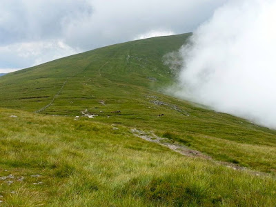
About now, a big cloud formed over Siabod. I might get to taste cloud! It did keep us cool though, and kindly didn't rain on us at all. We headed across the boggy paths past the lake. I was so light I didn't leave any footprints in the bogs. Sometimes Daddy sunk in to his ankles!

Walk, or Climb?

Now we reached the Daear Ddu (Daddy's translation: "Black Earth") ridge. It is a big rocky ridge, with an easy path up the back of it.

Daddy asked: "Walk? Or climb?" I wasn't sure.
Daddy said, "When you're back at school, and someone asks, 'what did you do this weekend?', your friends will say: 'we went shopping'; or 'visited granny'; or 'played in the park.'
"You can say: 'I climbed a MOUNTAIN!' "
Then Daddy asked again: "Walk? Or climb?" I said: "CLIMB!"

At the top of my first pitch! Daear Ddu, Moel Siabod
And so we put our climbing harnesses on. Daddy shortened the rope, so that I was always in view and didn't have too much distance to climb to him. Before we started, Daddy taught me the commands: "Safe!"; "Climb when Ready!"; "Climbing!" And then we were ready. Daddy went up a bouldery but grippy rock slab a little way and made himself safe. Then I climbed up to Daddy while he body-belayed me, and when I reached him he made me stand in a safe place.

We did this for the whole ridge. After each climb, Daddy asked, "the same or harder?". I kept saying harder! But we reached one section that I just couldn't climb. Daddy had already climbed it and tried to "climb like a small person", keeping his arms short and taking very little steps. But he didn't climb it small enough, so had to winch me up! Daddy said, "Are you ready? One, two, three..." then pulled. I half-climbed, and was half-pulled a little way up. He said it again, and I moved up a little bit further. He said it a few more times. Each time I moved up a little more, until I could see him and easily climb over the top of the big rocks. After that, Daddy didn't make it any harder. At first I had been scared, but afterwards I decided that this bit had been fun!

Seconding like a professional, Daear Ddu, Moel Siabod.
Near the top of the path, the ground became flatter. Daddy decided to use the whole 35m rope length to cover the ground more quickly, but he was worried about leaving me standing on my own. Daddy decided that I should "belay" him, like a proper climber. Daddy put a big sling around a rock, then attached me to it on a carabiner: I was going nowhere. As Daddy climbed, I "belayed" him, paying out the rope bit by bit and making sure it didn't get tangled. When Daddy reached the top, he set up a belay where he was, then I "seconded", dismantling the belay and collecting the sling and other gear as I went.

On Top Of The World Mountain

On the top, YAY! Moel Siabod.
The last little bit to the top was an easy scramble/walk so we didn't need the rope any more. I made it! YAY! At the very top of Moel Siabod is a trig point: a little stone tower that Daddy said they used in the olden days to measure how big all the mountains were. I had to stand on the trig point because it was the highest place on the mountain and Daddy said it didn't count unless I did. Daddy rewarded me with some more Tangfastics.

Left to right: Glyder Fach, me, Y Garn, Tryfan, Pen Yr Ole Wen.
The views from here were brilliant. It was a bit hazy, but we could see all of Snowdon and Tryfan and the Glyders, and even the Carneddau. All we then had to do was walk down the path on the other side of the mountain. I found this difficult because my legs were getting tired, but we did it carefully and actually very quickly.

Heading down the north path toward Capel Curig, Snowdon in the background

Soon we were walking back through the shade of the trees in the woods and along the stream. Daddy couldn't resist stopping to skim stones, and we both had a little paddle! The last bit of the walk was through flat fields and nice soft grass. Soon we crossed back over the bridge to the car park. When we got back I had a whole extra bag of crisps and daddy had a big flapjack. While we sat there a cheeky robin came toward us. Daddy threw some of the flapjack on the floor, which the robin ate and then it flew away.

What Next?

We drove back home along the Ogwen Valley toward Bethesda. Passing its most imposing resident, Daddy pointed to the mountain and asked, "Tryfan next?" Without hesitating, I said, "Aw, go on then!". I hope it will be cloudy...


Moel Siabod via Bryn Glo and Daear Ddu Ridge View Larger Map
Tuesday, 13 August 2013

Wild Camp & Scramble in the Carneddau

A wild camp in the shadow of Ysgolion Duon (The Black Ladders) followed by a scramble up Crib Lem Spur then a bimble over the Northern Carneddau. What can go wrong? Well, nothing sinister, but the Northern Carneddau are bigger than you (or rather I) thought. And trekking across thick gorse, heather, bracken, reeds and bog on a hot sunny day from Y Drum to the Sychnant Pass was not our idea of fun! So, having mentioned it, let's talk about what, actually, was fun...

Walking in to Ysgolion Duon, Cwm Llafar, Carneddau

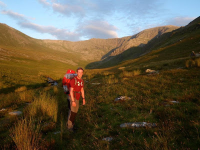
Walking into Ysgolion Duon was painless: we left my friend's house in Bethesda and walked through Gerlan until the road ran out and the paths began. We were welcomed by a friendly Jack Russell as we crossed the paths across fields to the CROW land. We made light work of crossing from the north to the south bank of the Cwm Llafar near the derelict dam. The weather was clear and bright, but humid and warm, making progress slow. We arrived at an adequate camp location a few hundred metres short of the Llech Ddu wall shortly after sunset, but we still had sufficient light to pitch our tents. Having done that, we set up and cooked by a huge boulder half in the Afon Llafar itself: Craig cooked his instant noodles on his solid fuel stove, while I boiled water, poured half of it over instant hot chocolate in my mug, then emptied packets of couscous and instant soup into my pot and let the heat do its work. Eating, waiting for nothing and watching the light fade. We briefly had company from a medium-sized rat: evidence to take even bio-degradable waste (e.g., apple cores) home.


Sunrise on The Llech Ddu wall, Cwm Llafar, Carneddau

In the morning, the clouds were brooding over Carnedd Dafydd. The sun briefly lit up the Walls of the Ladders and Llech Ddu below the clouds, before rising above them to re-establish the humidity. A few spots of rain indicated that now was the time to move, so we dismantled and packed up and made our way up the path to Crib Lem.

The scramble itself was uneventful but very entertaining, as Crib Lem so often is. The exposure was there as usual, especially with the cloud level well above the peaks. The wind was kind to us, allowing me to walk down most of the slab pitch, and the rain remained at bay, making the rock warm and dry and easy to negotiate.

Craig at the top of the slab, Crib Lem Spur, Carnedd Dafydd, Carneddau

Once on the top, we paused briefly to absorb the hazy view across Ogwen Valley to Tryfan, the Glyderau and the Snowdon Horseshoe. We then made our way toward and down the Bwlch Cyfrwyw-Drum, blatantly aware that the horrible slog  up Llewellyn lay ahead of us. Resigned to the misery, we picked a conversational pace and plodded and chatted on. Surprisingly, this tactic rendered the ascent impotent and time passed unnoticeably as we occupied our minds with inconsequential discussion.

Following a brief pause at the top of Llewellyn, we gained speed down toward and across Foel Grach and Carnedd Gwenllian (Uchaf, recently renamed after the only true Princess of Wales), pausing slightly while I dropped my bag to properly claim the "summit". That done and heading across to Foel Fras, we chose a more direct route than the frequented path with the intention of hitting Bwlch y Gwryd more quickly. The tedium of the route had begun to set in, and we were just trying to get to the car at the other end!

Shortly after arriving at the Bwlch, we stopped before the top of Y Drum for a short rest and refreshment. The once clear valley of Afon Anafon was now filled with sea fog, the southwest-bound ocean cloud battling against the prevailing north-westerly winds, and losing, making great swirls of vapour in the sky. But soon, as we summited Y Drum, the fog was winning: a chance to practice some poor-visibility navigation! Craig and I pulled out our maps and compasses and measured paces to cairns, fences, corners and any feature we could find on the map. This exercise enlivened our journey for the better until the fog cleared as we headed down Drosgl toward Bwlch Y Ddeufaen.

Sea fog versus wind: wind winning! Y Drum, Carneddau

And from here (as I began) was where the tedium set in. Variable fog, heat, humidity; no more accessible water; and a flat but heavily vegetated trudge toward the Sychnant Pass. At least we can say we've done it. I don't think I'll be doing it again in a hurry though!


Route map, from Bethesda to Sychnant Pass over the Carneddau View Larger Map